
Esri Better Together
Maximize Your Esri Investment with GeoShield
GeoShield unifies operational and investigative data into actionable intelligence so teams can coordinate faster and prevent crime.
CJIS Compliant
100% Cloud Based
Ethical AI


Schedule a Technical Briefing
What You'll See In the Technical Briefing
How GeoShield creates unified operational visibility across desktop + mobile.
How analysts reduce time spent on data pulls and manual stitching.
How Esri integration works in your environment what connects, what changes, what doesn't.
A recommended next step: assessment scope tailored to your agency.
Better Together
GeoShield + Esri for Intelligence-Led Operations
Built to complement your Esri environment not replace it.
Briefing
Assessment
Pilot
Scale
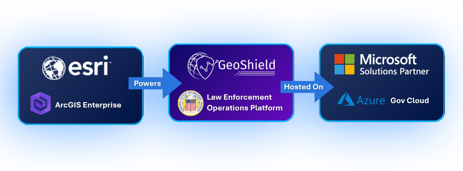
The Only Platform Where Esri Intelligence Meets Microsoft Security
GeoShield runs on Azure Government Cloud with CJIS compliance engineered from the ground up. ArcGIS Enterprise, GeoShield, and the M365 ecosystem operate within the same certified boundary eliminating the compliance gaps that complicate competing deployments.
What Changes for Your Agency
- Faster Coordination
Unified real-time operational visibility across all units and jurisdictions.
- Proactive Prevention
Intelligence-led analysis and pattern detection that moves from reactive to preventive.
- Better Officer Safety
Timely situational awareness that keeps officers informed before they arrive on scene.
- Clear Stakeholder Impact
Measurable outcomes and visual storytelling for command staff and community leaders.
Built for Every Role - Command to Analyst
Police Chief / Command Staff
Stop Crime Before It Happens
Force Multiplier
Pre-built ArcGIS dashboards and automated workflows let existing staff accomplish more with fewer resources.
Real-Time Situational Awareness
CAD, RMS, video, and spatial data unified in a single operational view.
Faster Decisions
Esri law enforcement dashboards deployed in days, not months no custom development required.
Crime Analyst
Stay Ahead of Criminal Activity
The full power of Esri on the data you already manage.
60–70% Less Manual Processing
Automated pipelines eliminate manual data import/export.
Full Esri Ecosystem Access
Agency data flows directly into all ArcGIS tools and solutions.
Advanced Spatial Analytics
Leverage Esri's Crime Analysis toolset on unified agency data for pattern recognition and hotspot mapping.
What Agencies Say
— Dave Weloth, ATAC Director, Ogden (UT) Police Department
— Kevin Blanchard, San Joaquin County (CA) Sheriff's Office
See GeoShield + Esri in Action
Schedule a technical briefing and get an assessment scope tailored to your agency.
© 2026 GeoShield. All rights reserved. Privacy: We use your information to respond to your request. We do not sell your data.